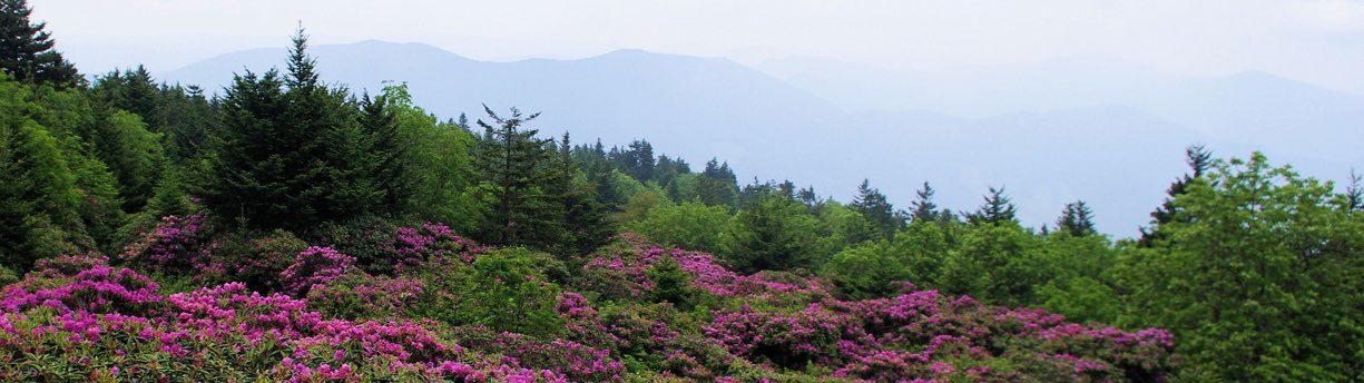
Opportunities for great hikes in the Blue Ridge Mountains are limited only by the imagination. From a gentle stroll over the grassy meadows of the New River State Park to the steep climbs of Mount Mitchell, hiking trails in the Blue Ridge National Heritage Area offer intimate contact with an ancient and biodiverse mountain landscape. Numerous hiking clubs and other organizations sponsor guided hikes for those who like company and interpretation along the way.
Hiking in National Parks, National Forests & on National Scenic Trails
The nation’s two most visited units of the National Park system, the Great Smoky Mountains National Park and the Blue Ridge Parkway, as well as the Carl Sandburg Home National Historic Site, have something for hikers of all skill levels.
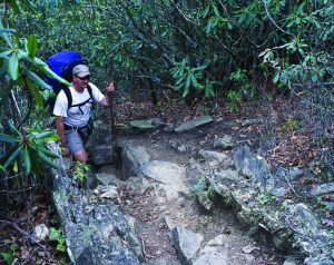
The Nantahala National Forest and Pisgah National Forest combined cover more than a million acres of the mountains and foothills of Western North Carolina. Literally hundreds of trails, from those well-traveled to remote wilderness trails, lace through these forests, making them a hiker’s wonderland.
The world-famous Appalachian National Scenic Trail, a 2,175-mile long public footpath running from Georgia to Maine, crosses North Carolina, running right down Main Street in the small community of Hot Springs.
Two-thirds of Graham County, located in the far western part of the Blue Ridge National Heritage Area, is National Forest land. It is the home of Joyce Kilmer Memorial Forest, Slickrock Creek Wilderness Area, the Nantahala National Forest, and it borders the Great Smoky Mountains National Park. The Appalachian Trail, Bartram Trail and Benton MacKaye Trail all lure avid backcountry hikers. Lake Santeetlah’s shoreline is more than 75% National Forest, insurance that it will never be spoiled by development. Forest Service roads lead to some of the most remote places in the Appalachians for those seeking solitude, a mountaintop or a waterfall to themselves for an afternoon.
Visit our National Parks & Trails Hiking page for more details.
Hiking in State Parks and Forests

Nine State Parks, two State Forests and the Green River Game Lands in Western North Carolina protect spectacular natural landmarks and provide outstanding recreational opportunities.
The Mountains-to-Sea Trail seeks to connect Clingman’s Dome in the Great Smoky Mountains National Park to Jockey’s Ridge State Park on the outer banks and is the flagship project of the North Carolina State Trails Program. Today, over 450 miles of the 1,000 mile route are open for use.
Visit our State Parks & Forests Hiking page for more details.
Hiking in the City—Asheville Urban Trail
 The 1.7 mile Asheville Urban Trail, a project of the Asheville Area Arts Council, guides walkers through the center of a city rich in art and history. Along the way, visitors will see the work of many local artists and learn about the city’s history at interpretive stops. The trail passes buildings with distinctive architecture, through neighborhoods and past shops, restaurants, galleries and lively public spaces.
Hiking in Cherokee—Mingo Falls

A hike to Mingo Falls in the Big Cove Community takes you through the Qualla Boundary, home to the Eastern Band of Cherokee Indians. Mingo means “Big Bear” in the Cherokee language, and the spectacular 150-foot waterfall lives up to its name. It can be accessed by taking an easy 10-minute hike from the Mingo Falls Campground on Big Cove Road.
From Asheville, take I-40 to Exit 27. Follow US 23/74 to Exit 81 at Sylva. Drive west on US 74 for 9.7 miles. Take exit 74, continue on US 441 north for 5.2 miles. Turn right at the traffic light at US 19 and continue 0.4 miles. Turn left at next traffic light in the direction of the Great Smoky Mountains National Park (staying on US 441 north). Continue for 2.3 miles. Turn right on Big Cove Road. Continue for 5.2 miles. Turn right, cross the bridge to the parking lot and trail.
 Hiking in a Garden Park—Pearson’s Falls
A short but exquisitely beautiful hike in a peaceful glen, the quarter-mile Glen Trail takes hikers past the 90-foot Pearson’s Falls and through a native wildflower garden with plants of remarkable diversity, including over 200 ferns, flowering plants, algae, and mosses.
Pearson’s Falls is located just off Route 176, four miles north of Tryon or three miles south of Saluda. Look for signs to the Falls.
Hiking Resources
Hiking maps and other trail information can be obtained from the Great Smoky Mountain National Park visitor centers, Blue Ridge Parkway visitor centers, US Forest Service ranger offices and State Park offices. Additional information is available on the following websites:
- Blue Ridge Parkway
- Great Smoky Mountains National Park
- National Forests in North Carolina (US Forest Service)
- North Carolina State Parks
- “Top 75 Western NC Mountain Hiking Trails” from romanticasheville.com.