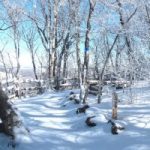
The Pisgah Loop Scenic Byway gives motorists an opportunity to view some of North Carolina’s most beautiful and remote landscapes. The byway begins north of Morganton at the intersection of N.C. 181 and Fish Hatchery Road (S.R. 1240). Following N.C. 181 north for 17 miles along Steele Creek, the byway traces the route of Kirk’s Raiders in the Civil War. It rises and winds up into the Pisgah National Forest with views of Table Rock and Hawksbill Mountain.
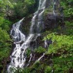
Continuing on N.C. 183, which parallels the Blue Ridge Parkway, the byway passes near the Linville Falls National Park Service Visitor Center and Campground. The byway then follows Old N.C. 105 (S.R. 1238) for 15 miles of mostly unpaved road alongside the Linville Gorge National Wilderness Area. Fourwheel-drive vehicles are required at this point. Old N.C. 105 winds along the crest of a line of mountains, providing unmatched views from both sides of the vehicle. Motorists may enjoy the scenery at the parking area and trail access for Linville Falls and Wiseman’s View. From the overlook, visitors have an eagle-eye view of the rock faces of Table Rock Mountain, Hawksbill Mountain, the Chimneys, and other rock faces as the Linville River roars through the gorge hundreds of feet below.
Continuing past Wiseman’s View, the byway crosses Dog Back Mountain, which gives motorists sweeping views of Lake James as the route begins its descent into the Catawba River Valley below. This section of byway intersects and parallels the Overmountain Victory Trail, used by patriots in the American Revolution en route to a crucial victory over forces loyal to the English at Kings Mountain.
The byway then follows N.C. 126 for five miles, with Lake James State Park in view on the right side of the highway. Motorists can view the clear blue water of Lake James upon reaching the Linville Public Access Area, which was the site of the fort battle and canoe scenes from the movie The Last of the Mohicans.
The byway continues a short distance and turns left onto Fish Hatchery Road (S.R. 1254 and S.R. 1240), which provides views of historic foothill farms tucked in among blooming mountain laurel, mountain streams and views of Table Rock Mountain.
Length: 47 miles
Drive Time: 2.5 hours
Note: The route is not recommended for recreational vehicles or buses. Four-wheel-drive vehicles required for unpaved portions.
For a detailed driving route and map, download the NC Department of Transportation’s Scenic Byways guide.